Upper Poudre Canyon Post-Fire Community Hub: A Centralized Location for Information on Wildfire, Post-Fire Flooding, and Recovery
Byline: Poudre Canyon FPD contributor, Maya Daurio
As wildfires increase in size, severity, and frequency, more and more communities across Colorado will experience wildfire, smoke from wildfires, and post-wildfire flooding. The upper Cache la Poudre Canyon community in northern Colorado, a rural, unincorporated area in the Poudre Canyon Fire Protection District, was severely impacted by the record-breaking 2020 Cameron Peak Fire. Some residents were evacuated for as many as 72 days. Others lost their homes in one of two days of extreme fire spread driven by wind down the canyon. The wildfire transformed the once heavily forested landscape and introduced new hazards in the form of post-wildfire flooding and debris flows, hazards that can last as many as ten years after a wildfire.
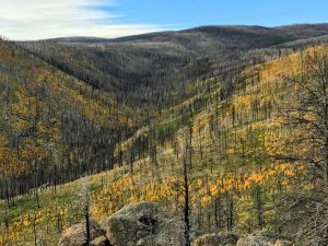
Figure 1. Aspen shoots regenerating in the Cameron Peak Fire burn area. Photo by author
There is a deep learning curve associated with experiencing wildfire and the post-wildfire flooding that often occurs in the following years. A community becomes accustomed to living in a particular kind of landscape, sometimes over many generations, as is the case for a number of families in the Poudre Canyon. A wildfire transforms that landscape so that not only does it appear drastically different, it also behaves entirely differently. New vegetation emerges, including opportunistic noxious weeds; streams overflow their banks, sometimes with catastrophic consequences; new alluvial fans begin to form as a result of debris flows; ash-laden flood waters suffocate fish; bird species such as the Lewis’s Woodpecker start inhabiting areas previously unsuitable for them; aspens and narrow-leaf cottonwoods saplings proliferate in the absence of the conifers which once dominated the landscape.
In the wake of disaster, communities are overwhelmed by the amount of information from various sources that all of a sudden become very important to access. An unincorporated area like the Poudre Canyon does not have a local government to help community members navigate the different aspects of recovery, rebuilding, or managing risk. County, state, federal and non-profit agencies distribute information via websites, webinars, emails, newsletters, guides, reports, publications, and sometimes in-person attendance at community meetings. It is hard to keep track of, especially if one is also navigating insurance claims or the devastating loss of a home, or worse, the loss of the life of a neighbor or family member. What did they say about hydrophobic soils? Where was it I can find a map to look at the debris flow potential on my land? What organization said they might be able to help with flood mitigation? Where can I sign up for announcements from my national forest?
People may interface with, whether in person or virtually, county engineers and emergency managers, the US Geological Survey, the Colorado Geological Survey, the US Forest Service, the Natural Resource Conservation District, the Federal Emergency Management Agency, consultants, non-profits, scientists, researchers, and the list goes on. There are emergency alerts to sign up for, the Burned Area Emergency Response (BAER) report, a report from the county based on their own assessment of the private roads most at risk of flooding, flood insurance to acquire, webinars and emails on recovery and where to dump metal debris, pick up sandbags, on the danger of asbestos exposure, about reforestation, and what funding may be available.
While overwhelming, much of this information is critical to safety. Disaster also can open up opportunities for accessing recovery resources through funding, hazard mitigation, and landscape and watershed restoration, so knowing where to locate these resources is essential.
As a PhD candidate and Public Scholar at the University of British Columbia (UBC) doing my research on the socioecological impacts of the Cameron Peak Fire, I was awarded funding from the Climate Emergency Fund as part of UBC’s Public Scholars Initiative to facilitate community dialog around hazards introduced by the wildfire. During a presentation by the New Mexico Forest and Watershed Restoration Institute at the SWERI Cross-Boundary Landscape Restoration Workshop in May 2023 in Fort Collins, I learned about the Hermit’s Peak/Calf Canyon Fire Resources Hub created to provide communities in northern New Mexico with post-fire watershed response and recovery information.
This was my inspiration to use the funding available to me to seek geospatial expertise from the Geospatial Centroid at Colorado State University to develop an ArcGIS Hub for the upper Poudre Canyon community. With the creative and technical design help of a student named Lucas Roy and the guidance of Sophia Linn, the Head of the Geospatial Centroid, we created the Upper Poudre Canyon Post-Fire Community Hub.
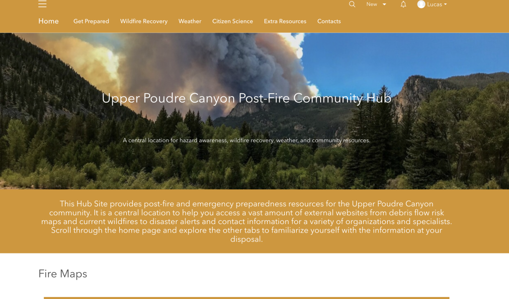
Figure 2. Graphic of the home page of the Upper Poudre Canyon Post-Fire Community Hub
An ArcGIS Hub uses Esri GIS software to create a cloud-based platform that facilitates engagement using a wide variety of visually engaging and user-friendly tools. Web maps, storymaps, embedded PDFs, screenshots, and spreadsheets can all be seamlessly linked to or displayed on a series of pages navigated through tabs. This makes it possible to provide a lot of information in a way that is not overwhelming and can be organized into useful categories to guide the user to find the information they want.
Our Hub Home page first takes people back in time to the Cameron Peak Fire and to a tragic and catastrophic debris flow that took four people’s lives through an interactive storymap created by Lucas Roy using photos and videos provided by community members, the Forest Service, and media. We wanted to situate the stories and places from the wildfire and its aftermath that most affected this community as a way of remembering and honoring the experiences of loss and devastation.
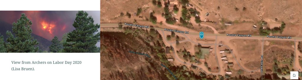
Figure 3. One of the photos featured on the storymap created by Lucas Roy.
We also had several other primary objectives. We wanted to provide information of interest and importance to the community which is difficult to discover online, such as this map created by Larimer County during the Cameron Peak Fire showing building damage across the footprint of the fire.
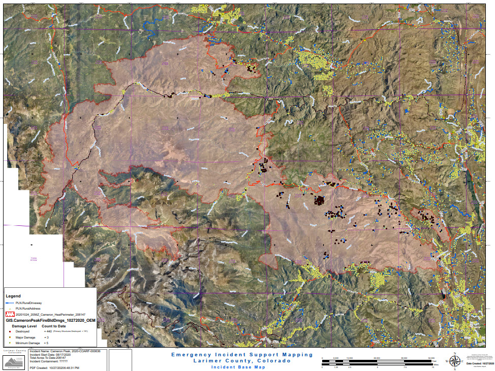
Figure 4. Map showing Cameron Peak Fire Building Damage produced by Larimer County on October 27, 2020.
At the bottom of the Home page, the tabs stretched across the top of the Hub are replicated as dropdown menus to provide both a sense of the structure of the Hub and quick links to resources under the categories of Current Conditions or Reducing Risk, for example.
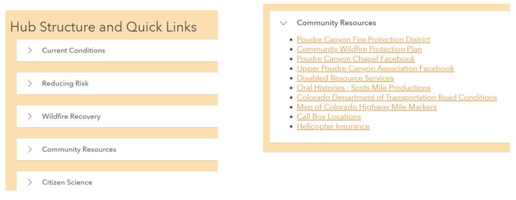
Figure 5. An example of the dropdown menus and quick links under each one on the Home page.
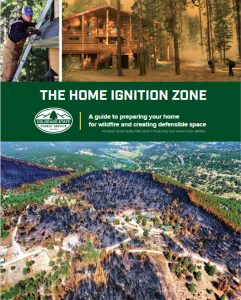
Figure 6. The cover of The Home Ignition Zone: A Guide to Preparing Your Home for Wildfire and Creating Defensible Space.
Knowing that wildfire will continue to be a part of this landscape, we featured many of the resources provided by the state to prepare for wildfire and reduce risk, such as this digitized guide to The Home Ignition Zone produced by the Colorado State Forest Service.
Because we think of the Hub as a centralized location for a variety of information, we included a page on Community Resources specific to the Upper Poudre Canyon community, such as a link to the 2023 Community Wildfire Protection Plan produced by the Poudre Canyon Fire Protection District.
Many scientists are conducting post-wildfire research in the Poudre Canyon following the Cameron Peak Fire and have relationships with landowners who have been affected or near whose homes their research sites are based. We provide the community with information on citizen science, volunteer opportunities, and research initiatives, such as this interactive map depicting research project information created by the Geospatial Centroid.
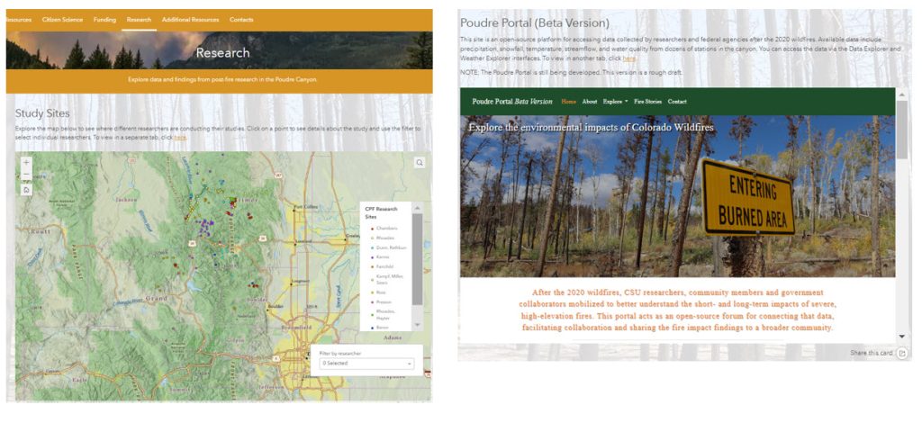
Figure 7. Map showing Cameron Peak Fire research sites, filtered by researcher, and a view of the Poudre Portal to discover data collected by researchers.
Finally, we provide a wide-ranging Contacts page with links to websites, names, emails, and phone numbers for organizations and agencies from The Ember Alliance to a beetle specialist with the Colorado State Forest Service.
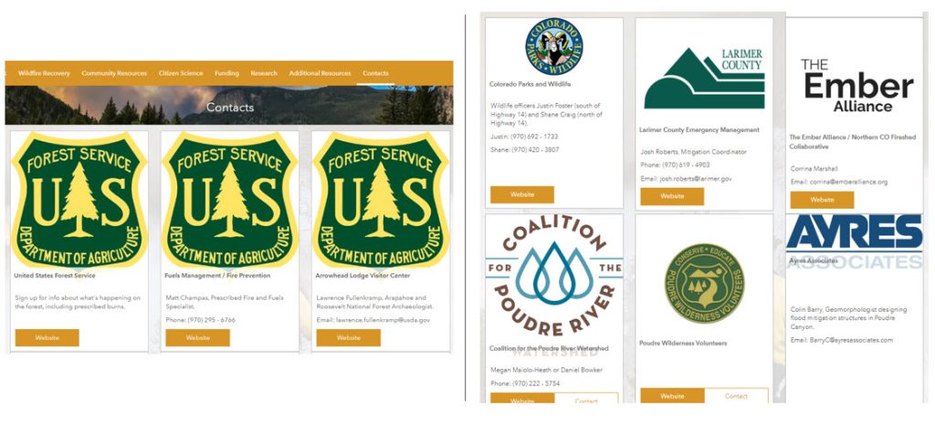
Figure 8. Image of the Contacts page of the Hub.
With the exception of location-specific information, this Hub could easily be adapted for other Colorado communities, whether they’re preparing for wildfire or have already experienced a wildfire. Much of this information is relevant for all Coloradoans. We encourage anyone interested in developing a Hub for your community to contact us. You can find our contact information at the bottom of the Home page.